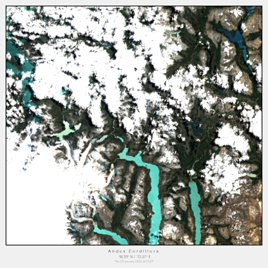
South America
Overall, Southern America's stunning natural landscapes, vibrant cities, and rich cultural heritage offer endless opportunities for exploration and discovery through satellite imagery.
Explore the Natural Wonders of Southern America from Above
Southern America is a region known for its stunning natural beauty, from the Amazon rainforest to the Andes Mountains. With satellite imagery, you can explore these natural wonders from a unique and fascinating perspective.
One of the most iconic natural landmarks in Southern America is the Amazon River. This massive river flows through several countries, including Brazil, Peru, and Colombia, and is the largest river in the world by volume. With satellite imagery, you can see the intricate patterns of the river's tributaries and the surrounding rainforest landscape, providing a unique and mesmerising perspective.
Another natural wonder in Southern America that is worth exploring through satellite imagery is the Atacama Desert in Chile. This vast, arid landscape is known for its otherworldly beauty and unique rock formations. With satellite imagery, you can see the intricate patterns of the desert's dunes and the striking contrast between the reddish-brown rock formations and the deep blue sky.
Discover the Urban Landscapes of Southern America from Above
Southern America is also home to some of the most vibrant and culturally rich cities in the world. With satellite imagery, you can explore these cities from a unique perspective and discover their unique architecture and landmarks.
One of the most iconic cities in Southern America is Rio de Janeiro in Brazil. This coastal city is known for its stunning beaches, vibrant culture, and iconic landmarks such as the Christ the Redeemer statue. With satellite imagery, you can see the impressive scale of the city's skyscrapers and the intricate patterns of the favelas (informal settlements) that dot the hillsides.
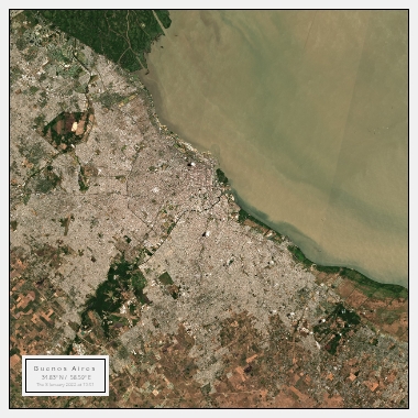
Another city in Southern America that is worth exploring through satellite imagery is Buenos Aires in Argentina. This cosmopolitan city is known for its European-style architecture and vibrant cultural scene. With satellite imagery, you can see the city's wide avenues and leafy parks, as well as the intricate patterns of the city's historic neighbourhoods.
Explore the Rich History and Culture of Southern America from Above
Southern America is home to a rich and diverse cultural heritage, with indigenous peoples, colonial history, and vibrant modern cultures. With satellite imagery, you can explore the region's historic sites and landmarks from above and gain a new perspective on their significance.
One of the most significant cultural landmarks in Southern America is Machu Picchu in Peru. This ancient Incan city is perched high in the Andes Mountains and is known for its impressive stone architecture and stunning mountain views. With satellite imagery, you can see the intricate layout of the city and the surrounding mountain landscape.
Another cultural landmark in Southern America that is worth exploring through satellite imagery is the colonial city of Cartagena in Colombia. This historic city is known for its colourful architecture, charming streets, and rich cultural heritage. With satellite imagery, you can see the historic buildings and plazas of the old town, as well as the surrounding coastal landscape.
Overall, Southern America's stunning natural landscapes, vibrant cities, and rich cultural heritage offer endless opportunities for exploration and discovery through satellite imagery.
